
We have been on a bit of a whirlwind tour the last few weeks. We have been moving a lot faster and farther than we did at the beginning of our trip. We’ve also been able to spend less time in each place.
Mostly, this is due to weather. It’s solidly fall now, and when we were in Bend the first weekend of October, the nighttime temps were dropping below freezing. In a sticks and bricks house, this is no big deal. For us, we start to worry about freezing tanks and lines. We weren’t really in danger of that since that’s caused by a harder, prolonged freeze, but it was certainly cold inside the RV. We have needed to stay in more campgrounds with electric hookups so we could use our little space heater. We knew we needed to get further south and get set up for winter before the cold really hits. We are planning to stay in a ski town somewhere, probably in the Colorado mountains, and rent an apartment for the winter.
We also had a couple of dates we wanted to hit. I registered for a race outside of Salt Lake City that was held 10/15, then it turns out Nik had a work thing in Denver the week of 10/17.
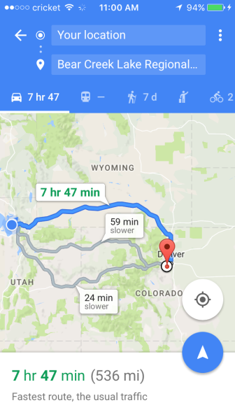
All that being the case, we’ve gone from Bend (on 10/2) to Denver (on 10/16) in two weeks. That’s a total of 1,200 miles.

Long drives have definitely gotten easier, but there are several places that are on our list to return to. One of these is Antelope Island State Park in Utah. (Another is the waypoint we stopped at for the night en route, Curlew National Grasslands. Such peace and quiet!)

Antelope Island is outside Salt Lake City and is actually an island inside the Great Salt Lake. It really is super salty. It’s what remains of a prehistoric inland sea (think the Dead Sea) called Lake Bonneville that covered a huge area. It’s salty enough that it can’t support fish life, but there are brine shrimp that support an unbelievable number of migratory birds.

Camping there was very weird. The ground is more… salt flats than dirt. There are powerful winds that come off the water. There are bison. You can see the water in any direction. But it sure is pretty.


I’m so used to camping by lakes or rivers that having the “shore” be in every single direction was not something I ever got used to.


There is awesome hiking though with some very rewarding views! Of course, the main reason we stopped here was because of this tiny little masochistic race.

The Frary Peak Hill Climb Race is put on by a group that mostly organizes ultra runs. The Frary Peak race, then, was the equivalent of a little fun run… for ultra runners. I, however, am not an ultra runner (at least, not yet). This race, which was only 6 miles, seemed easy until you factor in the elevation gain of about 1900′ feet in 3 miles. For comparison, this hike would take most fast hikers about 5 hours (rule of thumb: 1 hour for every 2 miles plus 1 hour for every 1000′ of elevation gain). You’re also running at altitude (the top is 6,950 feet or somewhere around there).

So this was a good challenge and a way to embrace my (relatively) newfound love of running trails. Frary Peak, as the highest point on Antelope Island, unsurprisingly had really great views. Any time the going got tough, there was ample distraction.

The race was super small, only 27 people. I was the only non-local, I believe. It was “time trial” style, sorta, with 2 runners starting each minute to spread out the pack a little bit on the narrow singletrack trail. Everyone being at slightly different points in their own race made for an interesting twist. Everyone was very friendly and encouraging, which is different from a giant, anonymous road race. Anytime people passed each other on the trail, you exchanged, “Good job!” with one another. There were many parts that you had no choice but to walk they were so steep.

At the top, we each touched the radio tower before turning around and heading back down. For those that care about running stats: going up my pace was around 21 min/mile (so steep!) and going down it was about 12 min/mile (don’t slip!). It took me 64 minutes to get to the top and 36 minutes to get down, for a total of 1 hr 40 min. I didn’t have any of the cramping or fueling issues I was worried about with such a brutal ascent, and I was definitely going at a race pace level of exertion (my lungs were on fire and the altitude didn’t help any). I was glad for all the hill work and leg strengthening training I did.
I didn’t see another runner the entire way down, which was pretty wild. But I did it! My quads are more sore than they have ever been. Races have definitely proven to be a good way to explore while we are on the road.

After the race, we did a quick half day visit to Salt Lake City. We saw the big Mormon (LDS) temple and then we drank some post-race celebratory beers at the Beer Hive Pub (highly recommended).

Then we woke up the next morning and drove to Denver!
We are definitely looking forward to a couple weeks of visiting with friends. 🙂

Nice report and photos! I would have liked that ridge race back when I was worth a damn.
LikeLike
Great pix at Antelope Island!!
LikeLike
Great post as usual! Running that race sounds really hard!
LikeLike
Thanks! It was! You should visit Antelope Island if you get the chance. Neat place, I bet you’d like the hiking there (way different than AT hikes, though).
LikeLike
I grew up in Utah. I remember one memorable trip to antelope island in the ’70s.
The causeway to the island was closed due to the high water level. There was probably 8-12 inches of water covering the road. One wind free day the water was like glass and I and my friend decided we could probably cross the causeway in his land cruiser. I could see the road under the water if I sat on the hood with my feet on the bumper. I pointed left or right to keep us centered on the road while my friend drove.
We made it and had the whole island to ourselves. I’ll never forget that day or what it felt like to be 17 and fearless!
LikeLike