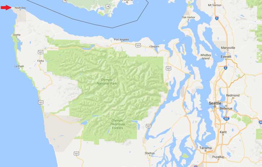
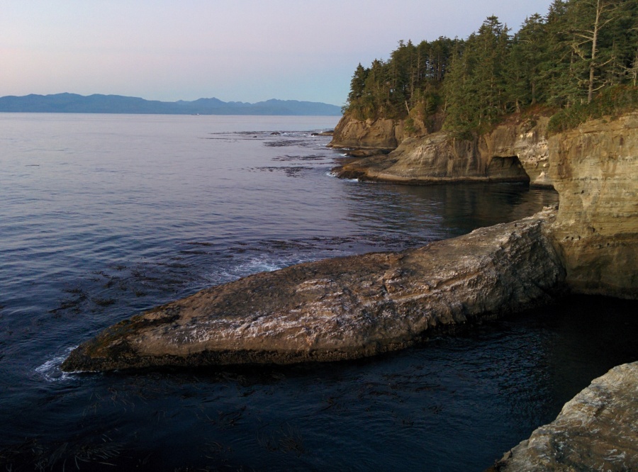
One of the things that we really wanted to do while we were on the Olympic Peninsula in Washington was check out the Northwest corner of the continental US, Cape Flattery. Cape Flattery also happens to be only about 360 feet shy of the westernmost point, Cape Alava, which is just a couple miles south.
Before we started researching it, we were expecting it to be like the significant points on the east coast (Eastport, ME or Key West, FL) where you can just drive right up to the point and take your pictures and drive away. Fortunately, we were pleasantly surprised that it was a little more challenging to get there.
The first step of going to visit the point is to stop in the town on Neah Bay and pick up a Makah Recreation Pass to be able to visit sites on the Makah Indian Reservation. It’s only $10 and well worth it. There is also a museum on the reservation that is a great place to learn more about the history of the tribe, but we didn’t know about it ahead of time and didn’t leave ourselves enough time to visit. Apparently the museum has some of the oldest human artifacts from North America. Check it out if you go and tell us how it is!
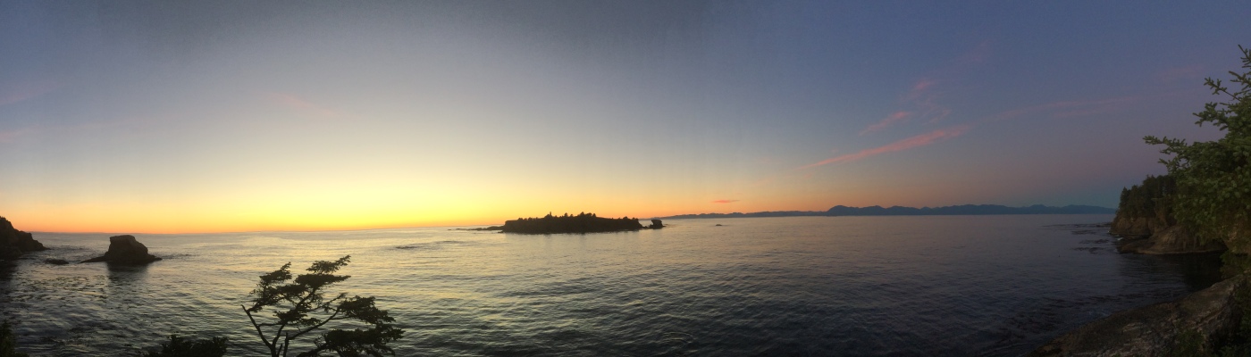
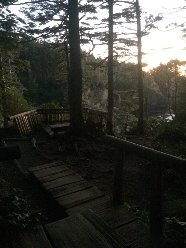
After getting the pass, you drive out towards the point and get to the trailhead about 20 minutes outside of town. The trail itself is about 3/4 of a mile long and is absolutely beautiful. At first the path starts out nice and wide, but quickly shrinks down to a beautiful boardwalk. We got there really late so our pictures are really dark but just before sunset the light lights up all of the trees with a beautiful orange glow.

It also was an amazing place for pictures of the sunset. It was cool to be one of the last people in the continental US to see the sun set that day.
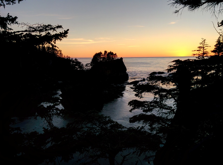

One of the coolest things though, was that as we left we kept hearing a sound like a fog horn but it was coming from under our feet. I don’t know how else to explain it. We read on a sign that it is caused by caves under the cape that are slowly worn away by the wind and waves.
It made for a really hauntingly beautiful way to end the day. We definitely recommend checking it out if you’re in the area!
